
What could be a better way to celebrate the great outdoors than a walk in the Black Mountains? Hopefully the sun will be shining and the ground will be dry enough for a picnic! NB: Due to access disputes, we no longer recommend returning via the road at the valley floor.

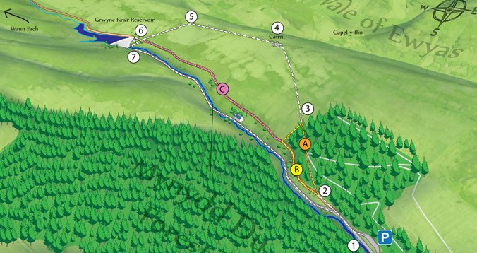
Click the map for a high resolution print version
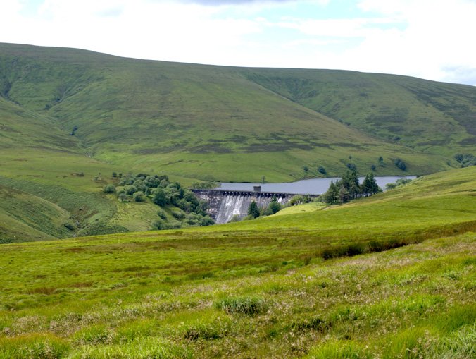
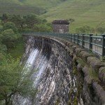
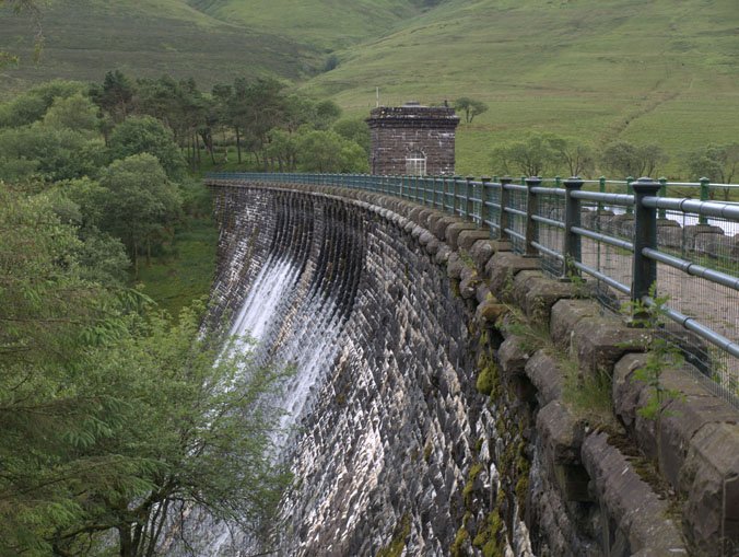
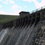
This month’s walk visits Grwyne Fawr Reservoir with its impressive dam. The main route is quite strenuous and will require sturdy footwear, however there is an easy alternative route if you don’t mind missing the view. The walk is 4.5 miles long.
To Get There:
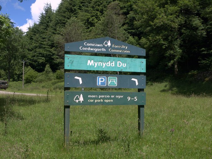
Take the Old Hereford Road out of Abergavenny. At Pantygelli, turn right before the garage. Follow the narrow road for about 2 miles to Forest Coal Pit. At the crossroads, shortly after Forest Coal Pit, turn left and immediately bear right, following the sign for Grwyne Fawr reservoir (7 miles). The road travels up the valley and through Mynydd Du Forest. After about 5 miles you will reach Mynydd Du forestry commission car park on the right.
Location of the car park
1
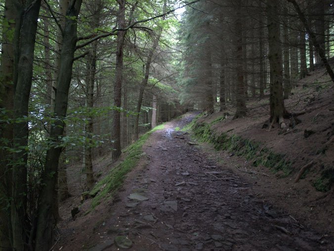
At the rear of the car park there is a footpath; follow this to the road and walk a short distance with the Grwyne Fawr river on your left. Follow the track marked with ‘No Vehicles’ signs which forks from the road to the right.
2
After about 200 metres the track forks again. The right hand fork leads up and through the woods, (route A) but may be closed due to logging activity. It was closed halfway up when I went and there was a sign attached to a tree at the bottom of the track saying so.
Route A
If the route is open, follow the track up the hill. Cross the logging road and pick up the footpath in the crook of the bend. Continue through the woods until you go through a gate at the boundary.
Route B & C
If the woods are closed, continue on the left hand track which follows the edge of the woods. After about 450 meters you will reach a gate and stile. At this point, for an easy walk (Route C), continue along the track to the dam. Otherwise for those with strong legs and footwear, go through and, almost immediately, turn right up the steep bank. Follow the boundary of the woods up the hill until you reach the gate mentioned in route A.
3
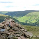
On the open hillside, continue in a Northerly direction diagonally up the hill. Although this is a public right-of-way, there is little path to speak of and the ground can be uneven, so watch your step. You are aiming for the ridge, a little to the left of the highest point. You should reach the ridge near a pile of stones.

The cairn on the ridge
4
Admire the view! The Vale of Ewyas and England beyond is to the North and Waun Fach is to the south. Head west along the ridgeway.
5
After about 1 km a (muddy) track forks off downhill to the left. Follow it down to the dam.
6
Go through the steel gate at the bottom of the hill and turn right onto the track that immediately passes through an iron gate.
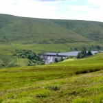
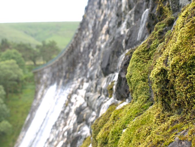
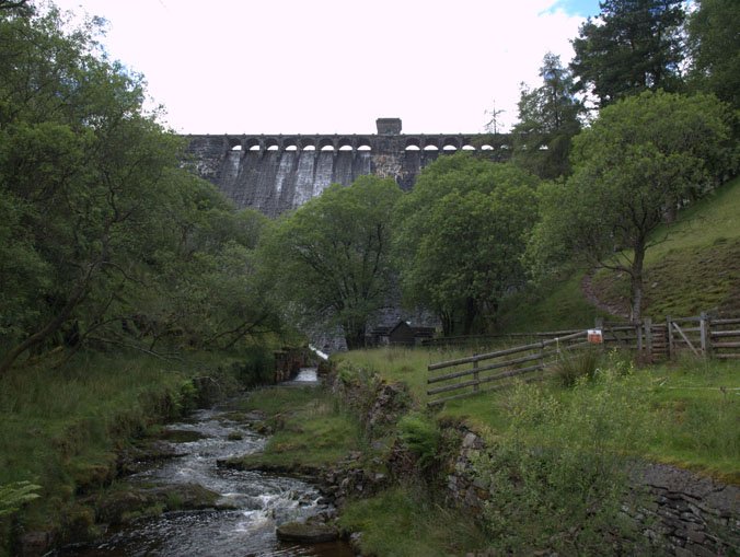
The Grwyne Fawr dam was opened in 1928, although construction had started in 1912. A large workforce was required and the foundations of the buildings that housed up to a thousand workers can still be seen around the site. The young Princes, William and Harry, controversially abseiled down the dam without helmets in 1998.
At the dam you can cross over to the other side where there is a nice spot for a picnic; but be mindful of the steep drops nearby. There is no route from this side, so cross back when you’re ready to head back.
7
NB: Due to access disputes, we no longer recommend returning via the road at the valley floor.
The route that I had planned took me back along the tarmac road that travels along the valley floor, beside the river. To get to the road I saw that there was a track on the OS map zigzagging its way down the north bank beside the dam, and indeed there was. At the bottom there was a gate and footbridge to take me to the other side. The buildings housing all the dam gubbins are gated off and, of course, one should not trespass near these. However, when I passed through the iron gate out on to the road, I discovered that the gate I had just come through was marked ‘no entry’. So, the access situation is a little unclear. Further along the road, there is a private property. When I first did this walk in 2012, access past the property was open. However, the gates across the road are now usually locked and I’m told that the road is not a public right of way. With all that in mind, and if you don’t want to risk potentially trespassing, as I may have done, you can return along the track that leaves via the iron gate at the top of the dam (route C). Whichever route you take, it’s about 2 miles back to the car park.
Gallery
-
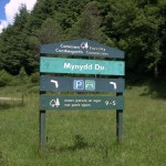
- Mynydd Du car park sign
-
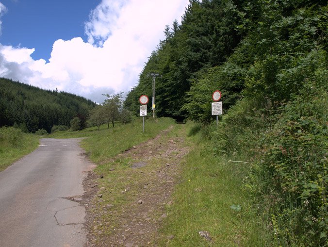
- The entrance to the track with ‘no vehicles’ signs
-

- Route A – through the woods
-
- The cairn on the ridge
-
- Grwyne Fawr Dam from the ridgeway
-
- Dam Footpath
-

- The Grwyne Fawr Resevoir

-

- Looking back across the dam

-
- Grwyne Far Dam

-
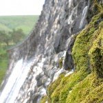
- Moss on the dam
-
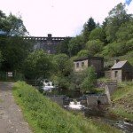
- The dam buildings from the valley floor

-

- Grwyne Fawr Dam
-

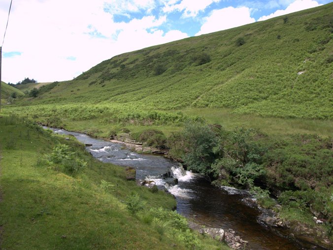
- The Grwyne Fawr river
Excellent went there today bank hol Monday raining had my wet weather gear on so no problem thourghly enjoyable cheers
Thanks Rob – That’s great to hear! – Cheers – Pete
I love your photos as I am not likely to be able to visit personally it is helpful to see them. My father lived in the village that was built for the workers which is probably where the picnic site is now. He was only 6 weeks old when they moved there but stayed for 7 years. A school and infirmary was built amongst other things. My Paternal grandfather was a crane driver and his brother a train driver. My maternal great grandfather also worked there along with several uncles. Romance blossomed weddings and babies followed and so it went on.
Thank you Denise
Hi Denise,
I’m glad to hear that you enjoyed looking at the photos. – It’s fascinating to hear about actual people who worked there – it makes it easier to imagine what it must have been like. – How funny that so many of your relatives worked/lived at the site! Thanks for your comment.
Pete
hi my father and is brother both worked on the dam in the twenties is brother fred was killed on the dam 1927 accident with over head crane was an inquest in abergaveney intend one day to read
To Denise and admin,
my Grandfather worked on the dam – and he married a local girl at Beaufort in 1921 and my father was born in Beaufort.
I have just found the book – stone and steam in the black mountains – which should be a good read when I get it.
I wonder if we can get into a light contact re the Village etc.
If so please indicate you are OK with this.
Many Thanks
Ken Osborne
You mention in Point 7 of your route guide that you did not know whether your return route along the road was trepassing or not. Dwr Cymru have confirmed for me that this road is open to walkers and the signage to the contrary should be ignored. Pob hwyl, David Thomas
Hi, just come back from the area and had a lovely walk up to the dam, seems a lot more than the 2 miles suggested
but I am 74 and it was a bit uneven on the old railway track. We came back down the road as advised on OS map and found it quite easy to follow the path down the north side bit steep but took it slowly…. no problems… the road back is not a pleasant experience as the farmer has painted signs on the road and erected …. beware of the bull…. in an attempt to intimidate walkers away from the area… barring these signs it was a very pleasant and beautiful walk back along the road with the river meandering its way down the valley… wet weather gear is suggested and the picnic/ survival pack …just in case…. a very pleasant day almost ruined by the thought that the farmer may be going to turn us back when we got to his farm area…… He has erected a notice near the car park end stating.. ROAD AHEAD CLOSED… it is not and Dwr Cymru should have these notices removed…
I would love to take my grandchildren but 4.5miles is too far for them. Is there no access via Crickhowell please?
Hi Patrick. There’s no other access really. If you walk from the car park directly to the resevoir, it’s 3.8 miles there and back. You can always stop for a picnic by the resevoir!
I’ve done the walk twice, and think it one of the most memorable walks I have ever undertaken. When the dam finally comes into view, it’s quite an event. I have devoted a chapter to the walk in a little book I publish called: “Corners of Wales”. And one thing I would like to know is: who lives in the house halfway up the road to the dam. And, how do they make a living?
We did this walk last weekend with two children aged 7 and 9 but got turned back by the farmer on the road who had let her bull out into a field that wasn’t fenced off from the road. The children were exhausted having done the walk uphill to the dam on very little legs and it was starting to rain. We either had to confront the bull or walk back on ourselves and up the hill to the right to avoid the farm. The children were crying and it totally ruined our walk – this was the furthest they had ever walked and they had loved it until that point. Something should be done about that farm. My OS map says it is a public footpath.
Just came back from a hike up the valley with my two boys. Camped on the banks of the Grwyne Fawr about 20 minutes north of the reservoir. Stunning scenery and the dam is very impressive.
Just done one of the versions and was astounded by farm gate across road reading ,’pPrivate road. Danger’. Turned back as did not want confrontation but should be open to walkers. Why no action by ROW Wales?
I have done this walk numerous times before happily and without incident, but on the latest occasion, while walking along the valley road, I was confronted by an aggressive lady who said I was trespassing – she said she was going to turn her dog (a large doberman) on me. She was abusive and threatening. It would be good to have the legal position clarified.
Reading these comments is a relief as I was also under the impression that the road was a public right of way that is being layed claim to by the occupant of the last house before the dam, who are deliberately misleading the public for what ever reason. With this in mind I today decided to continue on down the way that I believed to be correct when I was accosted by a rude aggressive woman who let her large dog out in an attempt to threaten myself and my partner, whilst swearing and shouting all sorts of nonsense at myself.Is there some sort of away to go about clarifying ownership and public rights of way? It was mentioned above and could be a really good thing for the Focus to cover!
I am fairly convinced the farmer is acting illegally. We all need to report these incidents and the blocked right of way. The rights of way are managed by national park rangers.
I’m wondering if it is permitted to leave a car in the Mynydd Du forestry commission car park overnight?
I along with my son and grandson did the walk 15th January. We walked up the valley and returned down the lower road. It was all OK until we came to the gated barrier across the road, saying permission required to use the road. After reading the comments regarding the legality of the access signs I will be contacting Welsh Water and the relevant local authority rights of way officer tomorrow
Such a beautiful walk. The whole journey was let down when we got the end of the valley road back. There was a sign for private road, but both of our maps showed a right of way. We also met a family with two young children. The only way back was to go about 50 mins back to the dam. It was getting late in the day and we decided to press on with caution. Just like the other comments here, a venomous lady met us on the road and shouted and screamed, threatened to set her huge dog on us, swore at the children, threatened to throw my dog in the river and other awful language. I still wonder if she’s blocking public access on purpose, but please don’t go through there. She is awful!!
Although the land including the road has been mapped as access land under the CROW Act, the exception below applies.
The CROW Act does not confer a right to walk on land covered by buildings or the curtilage of such land, or on land within 20m of a dwelling even though it may be mapped as access land.
Therefore it is not permitted to use the road to get past Grwyne Fawr Cottage and onwards to the dam.
This from the BBNPA ROW Officer asked to look into the problem