Whichever way you walk from town to the towpath you will pass a plethora of clues to life in Victorian times. Helen Morgan from Abergavenny Local History Society reportsHistory Society reports

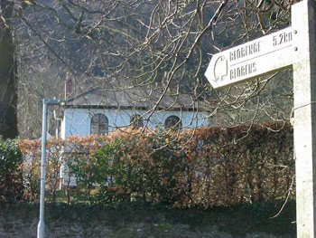
Ty Nant Craf, the old parsonage
 It was 150 years ago that the Merthyr, Tredegar and Abergavenny railway opened, enabling coal and iron to be moved to the Midlands and North of England. From Abergavenny Junction, north of the Monmouth Road station, it swept behind Park Crescent, across Pen y Pound and behind Avenue Road to the station on Brecon Road. It then crossed the A40 and went down the Link Road, across the river, past Waitrose and under the A465. It emerged in The Cutting before veering off towards Govilon.
By the 1880s, Llanfoist was bustling with a brewery, smithy and school. At the bottom of Kiln Road near the Spice Lounge were the coal yards where Thomas Hill’s tramroad terminated. Uphill on the right were the lime kilns. The trams that had travelled over the Blorenge down several inclines carried coal and iron as well as lime, crossing the canal over an iron bridge near the wharf. The warehouse (now a boathouse) stored iron that was to be loaded on to barges and transported down to Newport.
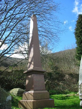
Downhill from the wharf, the red granite obelisk, marking the grave of the ironmaster Crawshay Bailey (1789-1892), is one of the churchyard’s more distinctive features. Nearby is South Lodge, home to the brewery manager, with its colonial-style veranda. The brewery itself was between the church and the B4246.

South Lodge, formerly the brewery manager’s house
Across the B4246 is Glan-nant-llan, built in 1820 with gothic windows for John Price, a wealthy Abergavenny solicitor. The lane leading down to McDonalds is the old parish road, and attached to the nursery is a house, whose origins go back to the Middle Ages. Then it was known as Ty Nant Craf but by 1830 it had become the Parsonage, surrounded by farmland that provided extra income for the rector. Farther on, before you turn right towards the municipal cemetery, the pink house near the A465 is another industrial magnate’s home. Pen-yr-Wrlod (head of the meadow), home to Robert Wheeley, director of Blaenavon Ironworks, stands near the site of a small Roman fort that probably guarded a ford across the river.
Please join us for Roads and Rail, a guided historic walk on June 24, July 21 and August 19. Meet 2pm in the Byfield Car Park. Duration: about one hour. Everyone welcome. Contact David Morgan on 01873 737738l for further details.


